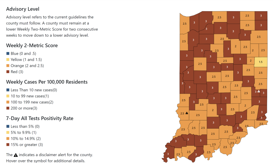
Indiana's COVID-19 color-coded county-by-county map was updated today and the amount of red increased dramatically. A "red" designation means that a county is at the highest level of community spread for the coronavirus. As of the latest map, with the exception of St. Joseph, LaGrange and Fulton counties, virtually all other Indiana counties in the WVPE listening area are in the red. LaGrange had been in the red for weeks and is now out of that designation as of today.
Also today the state is correcting a data processing error that has impacted COVID-19 reporting data since the start of the pandemic. It is unclear how much, if at all, that may be influencing the color-coded map.
In total, 45 counties are in red. That is nearly half of all of the state's 92 counties.


